
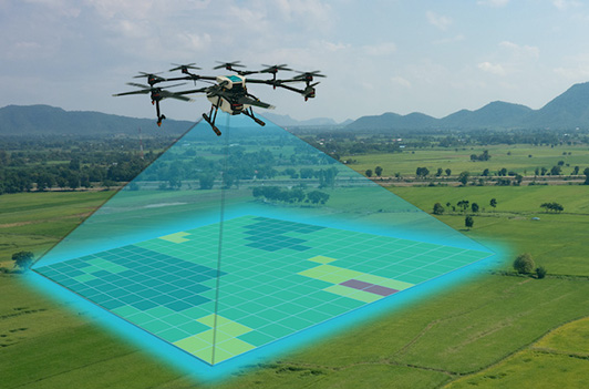
Survey and Mapping (S&M) Industrial terrains can be a daunting, time-consuming and often expensive task. Our professional S&M tools allow you to collect and analyze unlimited data and gather vital insights for informed decision making, planning and risk management for your business.
Drone Destination’s S&M services help in:
Our Service & Mapping services are cost-effective and efficient alternative to helicopters, provide high-quality photos and data collection, and are best utilized for sectors such as infrastructure, precision agriculture, mining and energy.


Copyright © 2023. All Rights Reserved.
Designed by - EMS Webtech